I still remember the first question a traveler asked me on the tarmac at Alejandro Velasco Astete Airport, bag still on her shoulder, breathing a little too fast: “Is it going to get worse up there, at the ruins?” She meant Machu Picchu. She was convinced that the postcard-famous citadel sat higher than the city she’d just landed in. I told her to relax — she was about to feel better, not worse, the moment she reached the ruins. She didn’t believe me until she saw it for herself two days later, breathing easily on a stone terrace while Cusco, more than 900 meters above her, was still giving her a mild headache in her memory.
That mix-up is one of the most common — and most avoidable — sources of anxiety I see among people planning their first trip to Peru. So let’s settle it clearly, with real numbers, before getting into everything else that the altitude difference actually changes about your trip.
So, Which Place Is Actually Higher?
Cusco is higher. Considerably higher.
- Cusco: 3,399 meters / 11,152 feet above sea level
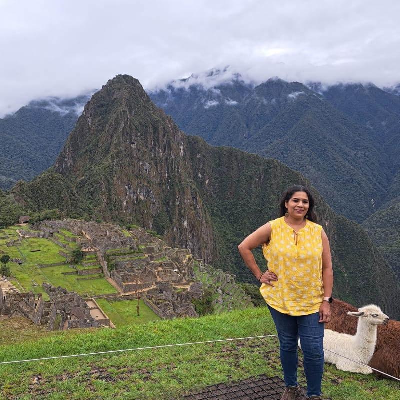
- Machu Picchu (citadel): 2,430 meters / 7,972 feet above sea level
- Difference: approximately 970 meters / 3,183 feet
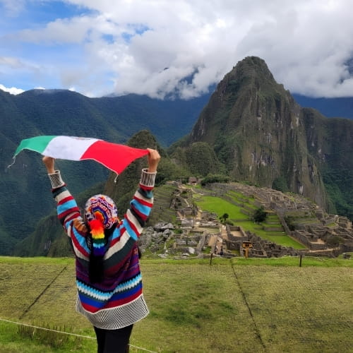
Put another way, Machu Picchu sits almost 1,000 meters below Cusco — roughly the elevation difference between Denver and the summit of Pikes Peak, if that helps put it in perspective. It’s one of the more counterintuitive facts about visiting Peru, because everything about Machu Picchu’s marketing — mist, clouds, mountain peaks in every photograph — suggests thin air and extreme altitude. In practice, the citadel occupies a much gentler elevation band, closer to what’s often called the ceja de selva, or “eyebrow of the jungle,” where the Andes begin dropping into the Amazon basin.
Why This Difference Actually Matters
This isn’t trivia — it directly affects how your body feels during the trip.
Atmospheric pressure drops with elevation, and with it, the amount of oxygen available in each breath. Using standard atmospheric pressure models, the air at Cusco’s elevation carries roughly 67% of the oxygen density found at sea level, while at Machu Picchu’s elevation it’s closer to 74%. That seven-point gap doesn’t sound dramatic on paper, but it’s often the difference between a traveler who spends their first day in Cusco with a headache and shortness of breath, and the same traveler walking comfortably around the Sun Gate two days later.
Peru’s Ministry of Culture, which manages entry to the archaeological park, doesn’t publish medical guidance, but the itinerary logic used by most Cusco-based operators reflects this reality: acclimatize in the highest place first, then move downward. Arriving in Lima, flying straight to Cusco, and pushing on to Machu Picchu within 24 hours is the single most common cause of altitude-related discomfort — not the ruins themselves.
Comparing the Whole Route
Cusco and Machu Picchu are only two points on a route that includes several other altitudes worth knowing, especially if you’re also considering the Sacred Valley or a trek.
| Location | Altitude (meters) | Altitude (feet) | Typical traveler experience |
|---|---|---|---|
| Rainbow Mountain (Vinicunca) | 5,036–5,200 m | 16,535–17,060 ft | Demanding; noticeable breathlessness even for acclimatized hikers |
| Dead Woman's Pass (Inca Trail) | 4,215 m | 13,829 ft | Highest point of the classic 4-day trek |
| Cusco | 3,399 m | 11,152 ft | Where most soroche (altitude sickness) symptoms occur |
| Calca | 2,929 m | 9,609 ft | Sacred Valley town, milder than Cusco |
| Urubamba | 2,870 m | 9,416 ft | Popular overnight stop before Machu Picchu |
| Ollantaytambo | 2,850 m | 9,350 ft | Train departure point for most visitors |
| Machu Picchu citadel | 2,430 m | 7,972 ft | Noticeably easier breathing than Cusco |
| Aguas Calientes | approx. 2,040 m | 6,693 ft | Lowest point most travelers reach on this route |
Two things stand out here. First, the entire Sacred Valley sits lower than Cusco, which is exactly why so many itineraries route travelers through Pisac, Urubamba or Ollantaytambo before Machu Picchu — it doubles as a built-in acclimatization stop, not just a sightseeing detour. Second, Aguas Calientes, the town at the base of the mountain, is actually the lowest point on this entire circuit, lower even than the ruins above it.
Following the Andes Downhill: A Traveler's Route in Order
Most first-time visitors follow a similar sequence, and the altitude story reads almost like a plot arc — tension, then relief.
Arrival in Cusco. Whether flying from Lima or, since 2025, arriving through the newer international routes into Cusco’s Alejandro Velasco Astete airport, this is where the altitude hits hardest and fastest. The cobblestone streets around Plaza de Armas sit at nearly the same elevation as some ski resort peaks in Colorado. I generally tell first-timers to plan nothing physically demanding for their first afternoon — walk slowly, drink coca tea if you’re curious about it (its effect on soroche is more cultural tradition than proven remedy, worth trying for the experience rather than counting on it medically), and let your body catch up.
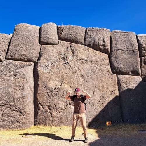
Cusco’s historic core and its layered history. Much of what travelers walk on in Cusco is literally built on top of Inca stonework — colonial churches and mansions raised directly onto polygonal Inca foundations, a detail you can see clearly around Plaza Regocijo, where massive interlocking blocks support Spanish-era arcades above them. It’s a physical timeline you’re walking through, not just a backdrop for photos.
Into the Sacred Valley. Descending toward Ollantaytambo or Urubamba, most travelers notice the change within an hour — easier breathing, warmer air, and a landscape that shifts from high Andean plateau to greener, terraced farmland framed by snow peaks.
The train to Aguas Calientes. This leg deserves its own mention because it’s not just transport — it’s part of the experience. PeruRail and Inca Rail both depart from Ollantaytambo (the most common departure point, since the Poroy station near Cusco adds significant travel time), and the roughly 1.5 to 2-hour ride tracks the Urubamba River downstream through a canyon that gets visibly narrower, greener and mistier the closer you get. Large panoramic windows on most services are designed specifically for this stretch. There’s a particular moment — usually somewhere past Km 88, where the classic Inca Trail begins — where the vegetation shifts abruptly from dry mountain scrub to genuine cloud forest, ferns and orchids included.
Aguas Calientes. The lowest point of the route, and it shows: the air feels noticeably thicker and more humid than anywhere else on the trip. This is also the last town before the ruins, reachable only by train or on foot — no road connects it to the outside world, which gives it a slightly isolated, jungle-outpost character that surprises people expecting another mountain town.
Machu Picchu. After the bus ride up the switchback road from Aguas Calientes (roughly 25 minutes), most travelers describe the same sensation: relief. Not just at finally seeing the citadel, but physically — the air feels easier than it did in Cusco, even though you’ve been walking uphill again.
What Changed in 2026
If you last researched a Peru trip more than a year ago, some of what you remember is outdated. According to the updated entry regulations published by Peru’s Ministry of Culture, the following changes apply for the current season:
- Inca Trail permits no longer include Machu Picchu citadel entry. Since January 1, 2026, trekkers must purchase a separate, capacity-controlled Machu Picchu ticket for the same date as their trek — previously this was bundled automatically.
- Strict one-hour entry windows, running from 6:00 a.m. to 3:00 p.m., with a limited grace period. Arriving outside your assigned window means being turned away, even with a valid ticket.
- No re-entry policy. Once you exit the archaeological park — for any reason — your visit for that ticket is over.
- High-season daily visitor caps rose from 4,500 to 5,600 during peak months (June 1–November 2, plus December 30–31), part of a broader effort to spread visitor flow across more circuits rather than concentrating everyone on the same paths.
- Inca Trail Route 6 was reinstated in 2026 after being deactivated for two years.
None of this changes the altitude facts above, but it does change how far in advance you should plan — tickets for the classic circuits now regularly sell out 60 or more days ahead during high season.
Two Climates, Not One
Because of the altitude gap, Cusco and Machu Picchu don’t just differ in how your lungs feel — they have genuinely different microclimates, something that’s easy to underestimate when packing.
Cusco’s dry season (roughly April through October) brings intensely sunny days but sharp nighttime drops, often down to 0–3°C (32–37°F), even when the daytime high reached a comfortable 20°C (68°F). Machu Picchu, sitting in that cloud-forest transition zone, almost never gets that cold — but it also almost never stays fully dry. Even in the driest months, brief morning mist or a passing shower at the ruins is common, simply because of the site’s exposure to moisture rising from the Amazon basin below. Travelers who pack only for “dry season” often get caught off guard at Machu Picchu specifically, not in Cusco.
When to Go
June through August remains the most reliable window for clear mountain views and minimal rain, though it’s also peak crowd season. April, May, September and October offer a close second — slightly higher chance of rain, noticeably fewer crowds, and often better light for photography in the early morning. If you’re specifically hoping to see the Inca Trail’s high-altitude sections without snow complications, late May tends to be a sweet spot, right after the rainy season ends but before peak-season crowds build up.
Packing for Both Altitudes: What to Wear
Because you’ll experience two climates in a matter of days, layering matters more here than almost anywhere else in South America.
For Cusco (cold, dry, high UV):
- A midweight alpaca or merino base layer — alpaca fiber handles temperature swings better than cotton and doesn’t retain moisture
- A windproof outer shell for the sharp evening drop
- A brimmed hat or cap; UV exposure at this altitude is significantly stronger than it feels
For Machu Picchu and Aguas Calientes (mild, humid, possible rain):
- A lightweight rain jacket, packable rather than heavy
- Quick-dry synthetic layers instead of cotton, which stays damp in the humidity
- Closed-toe walking shoes with grip — the stone steps inside the citadel are uneven and can be slick after rain
For genuine alpaca layers, Cusco’s historic center has several long-established, reputable options rather than the informal street stalls that often mix synthetic fibers into “100% alpaca” claims. Kuna, with a flagship store at Plaza Regocijo 202, is one of the most established names for tailored alpaca and vicuña outerwear. Sol Alpaca, at San Juan de Dios 214, offers a similarly high-quality range at source prices, avoiding the import markup you’d pay abroad. For a lighter, more casual alternative — hoodies and everyday pieces rather than formal coats — Paka has built a following among younger travelers for its softer, more packable alpaca garments. Standard retail hours in the historic center run roughly 9:00 a.m. to 6:00 p.m. Monday through Saturday, though most shops catering specifically to travelers, including these three, tend to stay open later, often until 8:00 or 9:00 p.m. in high season. A practical buying tip: ask to see the tag and feel the fiber before paying — genuine baby alpaca has a distinct softness and slight sheen that mixed-fiber imitations don’t replicate.
Quick Comparison at a Glance
| Cusco | Machu Picchu | |
|---|---|---|
| Altitude | 3,399 m / 11,152 ft | 2,430 m / 7,972 ft |
| Relative oxygen availability | ~67% of sea level | ~74% of sea level |
| Altitude sickness risk | Higher — most symptoms occur here | Lower — most visitors feel improved |
| Climate type | High Andean, dry and sharp | Cloud forest, humid and mild |
| Typical night temperature (dry season) | 0–3°C / 32–37°F | 12–15°C / 54–59°F |
| Best first stop for acclimatization | Yes — arrive here first | No — save for after acclimatizing |
If there’s one takeaway worth remembering, it’s this: don’t fear Machu Picchu’s altitude — respect Cusco’s. Give your body two full days at the higher elevation before pushing toward the ruins, and the descent through the Sacred Valley will do a lot of the acclimatization work for you naturally.
Every trip has details that don’t fit neatly into a general guide — pre-existing respiratory conditions, specific date availability, or how to sequence a longer Sacred Valley stay around the 2026 ticket windows. For those specifics, it’s worth writing directly to a Cusco-based team rather than relying on general advice: Machu Picchu Peru Travel, Calle Matara N°410, Cusco — email info@machupicchuperutravel.com, phone +51 971 021 010.